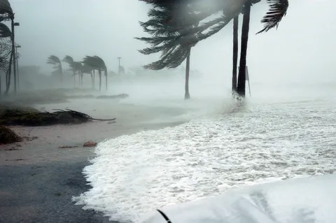
Met Office: yellow wind warning for southern England and Wales on Friday 23 October
The Met Office has issued a yellow warning for strong winds for the night of 22 to 23 October 2026. Gusts could reach 50–60 mph, and up to 70 mph on the coast.
Author: Editorial teamPublished: 2 min read

The Met Office, the UK's weather service, issued a yellow wind warning on 19 October 2026 for the end of the week. It covers the south of Great Britain and, according to the warning map, parts of southern England and Wales on Friday 23 October between 0:00 and 12:00.
What to expect on Thursday and Friday
According to the Met Office, a potentially deep low-pressure system could cross the UK on the night of Thursday to Friday (22–23 October). Forecasters note that there is uncertainty about its depth and position. That determines where the wind will be strongest.
The warning mentions gusts of 50–60 mph. In exposed coastal locations they could reach up to 70 mph. Friday is expected to be rainy and windy in many places.
Met Office Deputy Chief Meteorologist Tom Crabtree said that people should keep an eye on the forecast and be prepared for unsettled weather at the end of the week.

Will it be a named storm?
The BBC describes the situation as a possible first named storm of the autumn. However, we found no information on the Met Office pages we used to say that the system has been named. Under the rules of the Name our Storms programme, a storm is given a name when it could cause disruption or damage that would justify an amber or red warning. The current warning is yellow.
The Met Office's long-range forecast for 24 October – 2 November describes changeable weather, unsettled in places. Fronts bringing rain are expected to arrive from the Atlantic, and the risk of strong winds or gales remains.
What this means for Poles in the UK
A yellow warning means there is a possibility of disruption, not a certainty of serious damage. People travelling around southern England or Wales on Friday morning should check the forecast and travel and transport information before setting off. This applies especially to driving high-sided vehicles, such as vans, and to routes along exposed stretches. The latest warnings are on the Met Office website. The area covered by the warning, or its level, may still change.
Sources
This article was prepared automatically by AI from the listed sources and published without prior editorial review. Spotted a mistake? Use the “Report an error in this article” button.
Photos
- Cover: „sea, waves, coast, wind, weather”, author: dimitrisvetsikas1969, licence Pixabay Content License; cropped or resized.
- Photo 1: „fall, trees, autumn, winding road, autumn leaves”, author: 23001799, licence Pixabay Content License; cropped or resized.
Tags
Share with friends